 vesseltracker.com
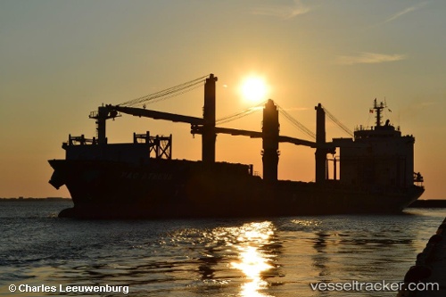
 MERATUS AMPANA
Current Status
Where is the vessel?
MERATUS AMPANA is currently in 10 nm NE of Belawan, based on AIS data received less than 1h ago.
Latest AIS update:
Current position: 3.92276° N, 98.77115° E (10 nm NE of Belawan)
Average speed (last 7 days): Loading…
Average speed (last 30 days): Loading…
Vessel profile: MERATUS AMPANA is a General Cargo Ship with dimensions 179m x 27m.
This page combines live AIS, route history, probable destination signals, nearby traffic, and port activity for practical vessel monitoring.
The current position of vessel MERATUS AMPANA is 3.92276 lat / 98.77115 lng. Updated: 2026-05-01 11:08:03 UTCNearest reference points:
- 10 nm NE of Belawan
- Near Belawan
- 43 nm NE of Perbaungan
Currently sailing under the flag of Indonesia ![]()
MERATUS AMPANA built in 2002 year
Deadweight:
27403 tDetails:
Live Vessel MERATUS AMPANA Analytics (details, animations, etc.)
Recent AIS points (UTC):
2026-05-01 07:47:05 UTC · 3.92007, 98.77371 · SOG 0 kn · COG 316°2026-05-01 09:56:01 UTC · 3.92216, 98.77371 · SOG 0.4 kn · COG 246°
2026-05-01 10:56:04 UTC · 3.92286, 98.77141 · SOG 0 kn · COG 139°
2026-05-01 11:08:03 UTC · 3.92276, 98.77115 · SOG 0.1 kn · COG 139°