 vesseltracker.com
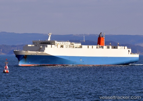
 DHARMA RUCITRA 8
Current Status
Where is the vessel?
DHARMA RUCITRA 8 is currently in 14 nm N of BIMA, based on AIS data received about 2h ago.
Latest AIS update:
Current position: 8.21723° S, 118.75370° E (14 nm N of BIMA)
Average speed (last 7 days): Loading…
Average speed (last 30 days): Loading…
Vessel profile: DHARMA RUCITRA 8 is a Passenger with dimensions m x m.
This page combines live AIS, route history, probable destination signals, nearby traffic, and port activity for practical vessel monitoring.
The current position of vessel DHARMA RUCITRA 8 is -8.21723 lat / 118.75370 lng. Updated: 2026-05-16 09:27:24 UTCNearest reference points:
- 30 nm N of BIMA
- 86 nm SE of BENETE
- 40 nm S of Waingapu, Sumba
Currently sailing under the flag of Indonesia ![]()
Details:
Live Vessel DHARMA RUCITRA 8 Analytics (details, animations, etc.)
Recent AIS points (UTC):
2026-05-16 07:34:51 UTC · -8.33108, 119.29136 · SOG 17.6 kn · COG 274°2026-05-16 07:48:51 UTC · -8.32850, 119.22336 · SOG 17.1 kn · COG 282°
2026-05-16 09:27:24 UTC · -8.21723, 118.75370 · SOG 17.3 kn · COG 285°
2026-05-16 09:27:24 UTC · -8.21723, 118.75370 · SOG 17.3 kn · COG 285°