 vesseltracker.com
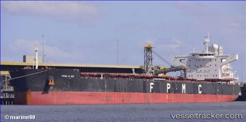
 SEA ROSE
Current Status
Where is the vessel?
SEA ROSE is currently in 66 nm W of Wusong Pt, based on AIS data received about 1h ago.
Latest AIS update:
Current position: 2.89167° N, 120.43500° E (66 nm W of Wusong Pt)
Average speed (last 7 days): Loading…
Average speed (last 30 days): Loading…
Vessel profile: SEA ROSE is a Bulk Carrier with dimensions m x m.
This page combines live AIS, route history, probable destination signals, nearby traffic, and port activity for practical vessel monitoring.
The current position of vessel SEA ROSE is 2.89167 lat / 120.43500 lng. Updated: 2026-04-25 04:04:21 UTCNearest reference points:
- 80 nm SE of Labuan Haji
- 81 nm E of Muara Pantai
- 43 nm E of Sibuko Bay
Currently sailing under the flag of Indonesia ![]()
Details:
Live Vessel SEA ROSE Analytics (details, animations, etc.)
Recent AIS points (UTC):
2026-04-25 01:22:17 UTC · 2.97167, 120.02333 · SOG 9 kn · COG -1°2026-04-25 02:34:24 UTC · 2.93667, 120.20333 · SOG 9 kn · COG -1°
2026-04-25 03:40:19 UTC · 2.90500, 120.37333 · SOG 9 kn · COG -1°
2026-04-25 04:04:21 UTC · 2.89167, 120.43500 · SOG 9 kn · COG -1°