 vesseltracker.com
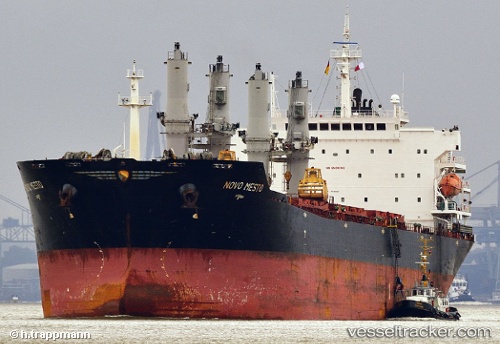
 MANALAGI TARA
Current Status
Where is the vessel?
MANALAGI TARA is currently in 30 nm NW of Wamsasi, based on AIS data received about 4h ago.
Latest AIS update:
Current position: 3.17292° S, 125.85469° E (30 nm NW of Wamsasi)
Average speed (last 7 days): Loading…
Average speed (last 30 days): Loading…
Vessel profile: MANALAGI TARA is a Bulk Carrier with dimensions 25m x 190m.
This page combines live AIS, route history, probable destination signals, nearby traffic, and port activity for practical vessel monitoring.
The current position of vessel MANALAGI TARA is -3.17292 lat / 125.85469 lng. Updated: 2026-05-15 15:31:23 UTCNearest reference points:
- 69 nm NW of Wainibe
- 55 nm S of Labuha, Molucas
- Near Ambon
Currently sailing under the flag of Indonesia ![]()
MANALAGI TARA built in 2005 year
Deadweight:
53626 tDetails:
Live Vessel MANALAGI TARA Analytics (details, animations, etc.)
Recent AIS points (UTC):
2026-05-15 15:31:23 UTC · -3.17292, 125.85469 · SOG 10.2 kn · COG -1°2026-05-15 15:31:23 UTC · -3.17292, 125.85469 · SOG 10.2 kn · COG -1°
2026-05-15 15:31:23 UTC · -3.17292, 125.85469 · SOG 10.2 kn · COG -1°
2026-05-15 15:31:23 UTC · -3.17292, 125.85469 · SOG 10.2 kn · COG -1°