 vesseltracker.com
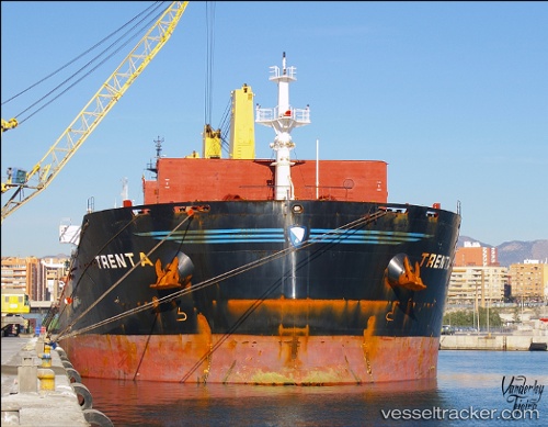
 MANALAGI VIRA
Current Status
Where is the vessel?
MANALAGI VIRA is currently in 10 nm S of Santan Terminal, based on AIS data received about 2h ago.
Latest AIS update:
Current position: 0.26891° S, 117.57560° E (10 nm S of Santan Terminal)
Average speed (last 7 days): Loading…
Average speed (last 30 days): Loading…
Vessel profile: MANALAGI VIRA is a Bulk Carrier with dimensions 32m x 190m.
This page combines live AIS, route history, probable destination signals, nearby traffic, and port activity for practical vessel monitoring.
The current position of vessel MANALAGI VIRA is -0.26891 lat / 117.57560 lng. Updated: 2026-04-25 20:02:42 UTCNearest reference points:
- Near Santan Terminal
- 16 nm SE of Santan Terminal
- 22 nm NE of Handil
Currently sailing under the flag of Indonesia ![]()
MANALAGI VIRA built in 2010 year
Deadweight:
56838 tDetails:
Live Vessel MANALAGI VIRA Analytics (details, animations, etc.)
Recent AIS points (UTC):
2026-04-25 18:14:39 UTC · -0.26870, 117.57479 · SOG 0.1 kn · COG 34°2026-04-25 20:02:42 UTC · -0.26891, 117.57560 · SOG 0.1 kn · COG 14°
2026-04-25 20:02:42 UTC · -0.26891, 117.57560 · SOG 0.1 kn · COG 14°
2026-04-25 20:02:42 UTC · -0.26891, 117.57560 · SOG 0.1 kn · COG 14°