 vesseltracker.com
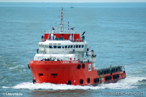
Synergy Explorer
Current StatusWhere is the vessel?
Synergy Explorer is currently in Near KEMAMAN, based on AIS data received less than 1h ago.
Latest AIS update:
Current position: 4.32006° N, 103.60289° E (Near KEMAMAN)
Average speed (last 7 days): Loading…
Average speed (last 30 days): Loading…
Vessel profile: Synergy Explorer is a Offshore Tug Supply Ship with dimensions 16m x 71m.
This page combines live AIS, route history, probable destination signals, nearby traffic, and port activity for practical vessel monitoring.
The current position of vessel Synergy Explorer is 4.32006 lat / 103.60289 lng. Updated: 2026-04-28 22:34:03 UTCNearest reference points:
- Near KEMAMAN
- Near Cukai
- 29 nm SW of Dulang Marine Terminal
Details:
Live Vessel Synergy Explorer Analytics (details, animations, etc.)
Recent AIS points (UTC):
2026-04-28 17:52:00 UTC · 4.81731, 103.89383 · SOG 7.2 kn · COG 209°2026-04-28 19:45:37 UTC · 4.61628, 103.77702 · SOG 7.4 kn · COG 208°
2026-04-28 21:59:14 UTC · 4.37813, 103.63901 · SOG 7.5 kn · COG 208°
2026-04-28 22:34:03 UTC · 4.32006, 103.60289 · SOG 6.8 kn · COG 222°