 vesseltracker.com
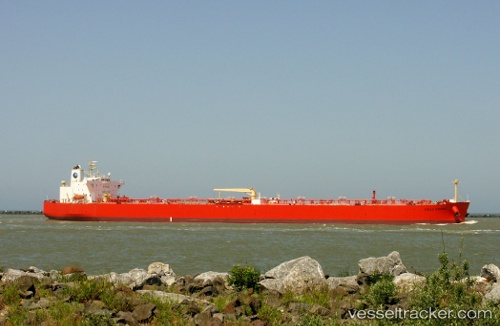
 EAGLE KINARUT
Current Status
Where is the vessel?
EAGLE KINARUT is currently in 62 nm S of Belida Terminal, based on AIS data received less than 1h ago.
Latest AIS update:
Current position: 3.14833° N, 104.81500° E (62 nm S of Belida Terminal)
Average speed (last 7 days): Loading…
Average speed (last 30 days): Loading…
Vessel profile: EAGLE KINARUT is a Crude Oil Tanker with dimensions m x m.
This page combines live AIS, route history, probable destination signals, nearby traffic, and port activity for practical vessel monitoring.
The current position of vessel EAGLE KINARUT is 3.14833 lat / 104.81500 lng. Updated: 2026-05-01 17:25:38 UTCNearest reference points:
- 80 nm SW of Terempa
- 39 nm SE of Belida Terminal
- 64 nm NE of PENGERANG
Currently sailing under the flag of Malaysia ![]()
Details:
Live Vessel EAGLE KINARUT Analytics (details, animations, etc.)
Recent AIS points (UTC):
2026-05-01 14:04:43 UTC · 3.12500, 104.78833 · SOG 2 kn · COG -1°2026-05-01 16:19:42 UTC · 3.14167, 104.81333 · SOG 0 kn · COG -1°
2026-05-01 16:28:41 UTC · 3.14167, 104.81500 · SOG 0 kn · COG -1°
2026-05-01 17:25:38 UTC · 3.14833, 104.81500 · SOG 0 kn · COG -1°