 vesseltracker.com
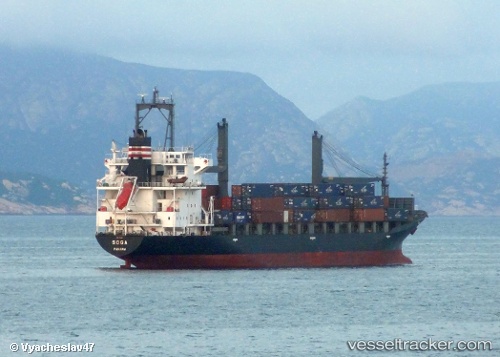
 Danum 172
Current Status
Where is the vessel?
Danum 172 is currently in 33 nm N of Tami Island, based on AIS data received about 1d ago.
Latest AIS update:
Current position: 6.22833° S, 147.98666° E (33 nm N of Tami Island)
Average speed (last 7 days): Loading…
Average speed (last 30 days): Loading…
Vessel profile: Danum 172 is a Container Ship with dimensions 160m x 25m.
This page combines live AIS, route history, probable destination signals, nearby traffic, and port activity for practical vessel monitoring.
The current position of vessel Danum 172 is -6.22833 lat / 147.98666 lng. Updated: 2026-05-14 20:28:21 UTCNearest reference points:
- 42 nm E of Tami Island
- Near Lae
Currently sailing under the flag of Malaysia ![]()
Danum 172 built in 1998 year
Deadweight:
17224 tDetails:
Live Vessel Danum 172 Analytics (details, animations, etc.)
Recent AIS points (UTC):
2026-05-13 10:27:50 UTC · -21.53167, 141.92000 · SOG 23 kn · COG -1°2026-05-14 20:28:21 UTC · -6.22833, 147.98666 · SOG 9 kn · COG -1°
2026-05-14 20:28:21 UTC · -6.22833, 147.98666 · SOG 9 kn · COG -1°
2026-05-14 20:28:21 UTC · -6.22833, 147.98666 · SOG 9 kn · COG -1°