 vesseltracker.com
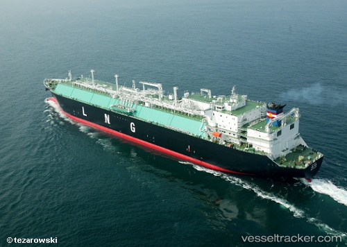
Seri Alam
Current StatusWhere is the vessel?
Seri Alam is currently in 71 nm W of Iba, based on AIS data received about 1h ago.
Latest AIS update:
Current position: 15.43983° N, 118.74610° E (71 nm W of Iba)
Average speed (last 7 days): Loading…
Average speed (last 30 days): Loading…
Vessel profile: Seri Alam is a Lng Tanker with dimensions 43m x 284m.
This page combines live AIS, route history, probable destination signals, nearby traffic, and port activity for practical vessel monitoring.
The current position of vessel Seri Alam is 15.43983 lat / 118.74610 lng. Updated: 2026-04-29 16:50:15 UTCNearest reference points:
- 34 nm W of Iba
- 19 nm SW of MARIVELES
- Near Nasugbu, Luzon
Details:
Live Vessel Seri Alam Analytics (details, animations, etc.)
Recent AIS points (UTC):
2026-04-29 16:05:03 UTC · 15.65789, 118.76487 · SOG 17.6 kn · COG 186°2026-04-29 16:05:03 UTC · 15.65789, 118.76487 · SOG 17.6 kn · COG 186°
2026-04-29 16:50:15 UTC · 15.43983, 118.74610 · SOG 17.3 kn · COG 188°
2026-04-29 16:50:15 UTC · 15.43983, 118.74610 · SOG 17.3 kn · COG 188°