 vesseltracker.com
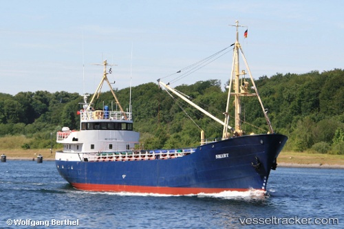
 SMART
SMART
Current Status
Where is the vessel?
SMART is currently in Near San Andrés, based on AIS data received less than 1h ago.
Latest AIS update:
Current position: 12.57347° N, 81.70225° W (Near San Andrés)
Average speed (last 7 days): Loading…
Average speed (last 30 days): Loading…
Vessel profile: SMART is a General Cargo Ship with dimensions 8m x 49m.
This page combines live AIS, route history, probable destination signals, nearby traffic, and port activity for practical vessel monitoring.
The current position of vessel SMART is 12.57347 lat / -81.70225 lng. Updated: 2026-05-14 19:45:56 UTCCurrently sailing under the flag of Colombia ![]()
SMART built in 1960 year
Deadweight:
640 tDetails:
Live Vessel SMART Analytics (details, animations, etc.)
Recent AIS points (UTC):
2026-05-14 16:50:07 UTC · 12.57348, -81.70225 · SOG 0 kn · COG 240°2026-05-14 18:04:56 UTC · 12.57355, -81.70225 · SOG 0 kn · COG 240°
2026-05-14 19:37:47 UTC · 12.57347, -81.70223 · SOG 0 kn · COG 240°
2026-05-14 19:45:56 UTC · 12.57347, -81.70225 · SOG 0.1 kn · COG 240°