 vesseltracker.com
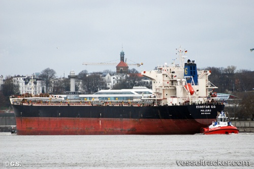
Ecostar G.o.
Current StatusWhere is the vessel?
Ecostar G.o. is currently in 368 nm NW of Akpo, based on AIS data received about 1h ago.
Latest AIS update:
Current position: 2.20333° N, 57.81333° E (368 nm NW of Akpo)
Average speed (last 7 days): Loading…
Average speed (last 30 days): Loading…
Vessel profile: Ecostar G.o. is a Bulk Carrier with dimensions 32m x 224m.
This page combines live AIS, route history, probable destination signals, nearby traffic, and port activity for practical vessel monitoring.
The current position of vessel Ecostar G.o. is 2.20333 lat / 57.81333 lng. Updated: 2026-05-16 05:20:18 UTCNearest reference points:
- Open sea, approx. 401 nm off the nearest listed port
- Open sea, approx. 400 nm off the nearest listed port
- Open sea, approx. 403 nm off the nearest listed port
Details:
Live Vessel Ecostar G.o. Analytics (details, animations, etc.)
Recent AIS points (UTC):
2026-05-16 02:38:17 UTC · 2.61500, 58.13167 · SOG 11 kn · COG -1°2026-05-16 03:47:21 UTC · 2.43833, 57.99667 · SOG 11 kn · COG -1°
2026-05-16 04:29:15 UTC · 2.33666, 57.90833 · SOG 11 kn · COG -1°
2026-05-16 05:20:18 UTC · 2.20333, 57.81333 · SOG 11 kn · COG -1°