 vesseltracker.com
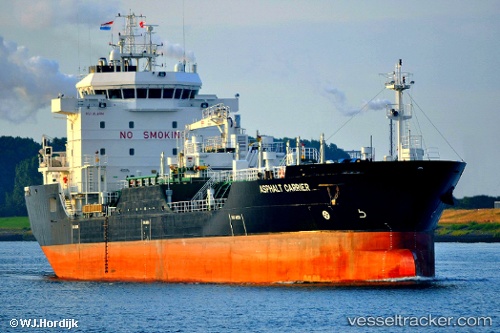
Asphalt Carrier
Current StatusWhere is the vessel?
Asphalt Carrier is currently in Near Emmastad, based on AIS data received less than 1h ago.
Latest AIS update:
Current position: 12.12288° N, 68.92133° W (Near Emmastad)
Average speed (last 7 days): Loading…
Average speed (last 30 days): Loading…
Vessel profile: Asphalt Carrier is a Bitumen Tanker with dimensions 18m x 109m.
This page combines live AIS, route history, probable destination signals, nearby traffic, and port activity for practical vessel monitoring.
The current position of vessel Asphalt Carrier is 12.12288 lat / -68.92133 lng. Updated: 2026-04-24 06:04:27 UTCNearest reference points:
- Near Bullenbaai
- Near Las Piedras
- 24 nm NW of Palm Beach
Details:
Live Vessel Asphalt Carrier Analytics (details, animations, etc.)
Recent AIS points (UTC):
2026-04-24 02:28:34 UTC · 12.12305, -68.92131 · SOG 0 kn · COG 87°2026-04-24 04:16:34 UTC · 12.12298, -68.92128 · SOG 0 kn · COG 88°
2026-04-24 04:48:59 UTC · 12.12293, -68.92132 · SOG 0 kn · COG 87°
2026-04-24 06:04:27 UTC · 12.12288, -68.92133 · SOG 0 kn · COG 87°