 vesseltracker.com
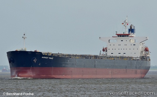
Harvest Peace
Current StatusWhere is the vessel?
Harvest Peace is currently in Near Gandhar, based on AIS data received about 1h ago.
Latest AIS update:
Current position: 21.09463° N, 72.65774° E (Near Gandhar)
Average speed (last 7 days): Loading…
Average speed (last 30 days): Loading…
Vessel profile: Harvest Peace is a Bulk Carrier with dimensions 32m x 225m.
This page combines live AIS, route history, probable destination signals, nearby traffic, and port activity for practical vessel monitoring.
The current position of vessel Harvest Peace is 21.09463 lat / 72.65774 lng. Updated: 2026-05-13 19:57:18 UTCNearest reference points:
- Near Gandhar
- Near Mithivirdi
- Near DAHEJ
Details:
Live Vessel Harvest Peace Analytics (details, animations, etc.)
Recent AIS points (UTC):
2026-05-13 16:07:09 UTC · 20.77801, 72.54501 · SOG 10.6 kn · COG 8°2026-05-13 18:16:09 UTC · 21.00905, 72.61914 · SOG 4.4 kn · COG 92°
2026-05-13 19:10:04 UTC · 21.08791, 72.65913 · SOG 2.2 kn · COG 359°
2026-05-13 19:57:18 UTC · 21.09463, 72.65774 · SOG 0 kn · COG 359°