 vesseltracker.com
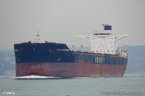
Cape Istanbul
Current StatusWhere is the vessel?
Cape Istanbul is currently in Near Majistan/Zhoushan, based on AIS data received less than 1h ago.
Latest AIS update:
Current position: 30.11658° N, 122.17702° E (Near Majistan/Zhoushan)
Average speed (last 7 days): Loading…
Average speed (last 30 days): Loading…
Vessel profile: Cape Istanbul is a Bulk Carrier with dimensions 45m x 289m.
This page combines live AIS, route history, probable destination signals, nearby traffic, and port activity for practical vessel monitoring.
The current position of vessel Cape Istanbul is 30.11658 lat / 122.17702 lng. Updated: 2026-05-15 22:48:33 UTCNearest reference points:
- Near Majistan/Zhoushan
- Near JINHAI HEAVY INDUSTR
- Near ZHOUSHAN
Details:
Live Vessel Cape Istanbul Analytics (details, animations, etc.)
Recent AIS points (UTC):
2026-05-15 19:39:30 UTC · 30.11656, 122.17701 · SOG 0 kn · COG -1°2026-05-15 19:51:29 UTC · 30.11657, 122.17701 · SOG 0 kn · COG -1°
2026-05-15 22:12:29 UTC · 30.11656, 122.17698 · SOG 0 kn · COG -1°
2026-05-15 22:48:33 UTC · 30.11658, 122.17702 · SOG 0 kn · COG -1°