 vesseltracker.com
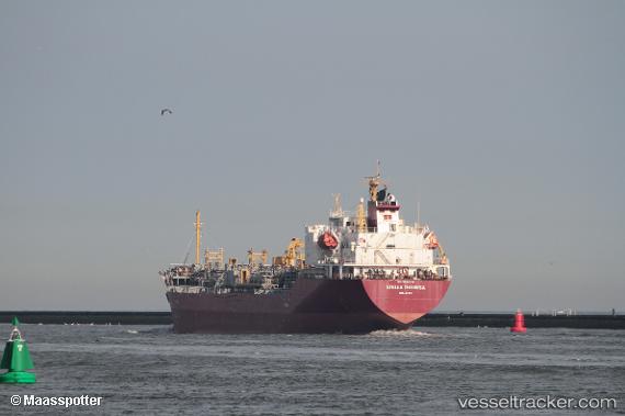
 Stella Theresa
Current Status
Where is the vessel?
Stella Theresa is currently in Near Jorf Lasfar, based on AIS data received about 2d ago.
Latest AIS update:
Current position: 33.12887° N, 8.62809° W (Near Jorf Lasfar)
Average speed (last 7 days): Loading…
Average speed (last 30 days): Loading…
Vessel profile: Stella Theresa is a Chemical Oil Products Tanker with dimensions 126m x 21m.
This page combines live AIS, route history, probable destination signals, nearby traffic, and port activity for practical vessel monitoring.
The current position of vessel Stella Theresa is 33.12887 lat / -8.62809 lng. Updated: 2026-05-11 17:14:13 UTCNearest reference points:
- Near Jorf Lasfar
- 21 nm NW of El Jadida
- 44 nm NW of El Jadida
Currently sailing under the flag of Marshall Is ![]()
Stella Theresa built in 2011 year
Deadweight:
12601 tDetails:
Live Vessel Stella Theresa Analytics (details, animations, etc.)
Recent AIS points (UTC):
2026-05-11 17:14:13 UTC · 33.12887, -8.62809 · SOG 0.1 kn · COG 301°2026-05-11 17:14:13 UTC · 33.12887, -8.62809 · SOG 0.1 kn · COG 301°
2026-05-11 17:14:13 UTC · 33.12887, -8.62809 · SOG 0.1 kn · COG 301°
2026-05-11 17:14:13 UTC · 33.12887, -8.62809 · SOG 0.1 kn · COG 301°