 vesseltracker.com
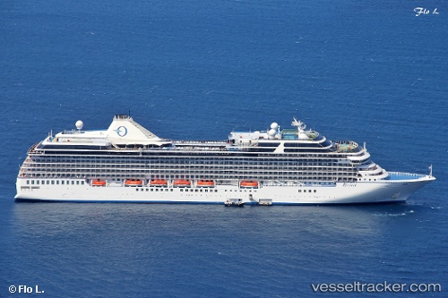
 Riviera
Current Status
Where is the vessel?
Riviera is currently in 60 nm NW of Attu Island, based on AIS data received less than 1h ago.
Latest AIS update:
Current position: 53.83574° N, 172.47473° E (60 nm NW of Attu Island)
Average speed (last 7 days): Loading…
Average speed (last 30 days): Loading…
Vessel profile: Riviera is a Cruise Ship with dimensions 240m x 32m.
This page combines live AIS, route history, probable destination signals, nearby traffic, and port activity for practical vessel monitoring.
The current position of vessel Riviera is 53.83574 lat / 172.47473 lng. Updated: 2026-05-14 07:31:44 UTCNearest reference points:
- 57 nm SW of Zagorow
Currently sailing under the flag of Marshall Is ![]()
Riviera built in 2012 year
Deadweight:
7662 tDetails:
Live Vessel Riviera Analytics (details, animations, etc.)
Recent AIS points (UTC):
2026-05-14 04:19:30 UTC · 53.52636, 171.23679 · SOG 15.4 kn · COG 63°2026-05-14 04:55:58 UTC · 53.59859, 171.46898 · SOG 15.1 kn · COG 64°
2026-05-14 06:37:09 UTC · 53.76671, 172.11697 · SOG 14.7 kn · COG 71°
2026-05-14 07:31:44 UTC · 53.83574, 172.47473 · SOG 14.6 kn · COG 72°