 vesseltracker.com
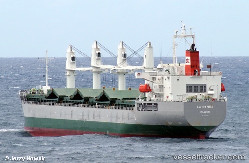
 La Bamba
Current Status
Where is the vessel?
La Bamba is currently in Near BUCEO, based on AIS data received about 13d ago.
Latest AIS update:
Current position: 34.99141° S, 56.06820° W (Near BUCEO)
Average speed (last 7 days): Loading…
Average speed (last 30 days): Loading…
Vessel profile: La Bamba is a Bulk Carrier with dimensions 178m x 29m.
This page combines live AIS, route history, probable destination signals, nearby traffic, and port activity for practical vessel monitoring.
The current position of vessel La Bamba is -34.99141 lat / -56.06820 lng. Updated: 2026-04-12 17:07:42 UTCNearest reference points:
- 12 nm S of Piriápolis
- 16 nm N of Cabo San Antonio
- Near JUAN LACAZE
Currently sailing under the flag of Marshall Is ![]()
La Bamba built in 2012 year
Deadweight:
37155 tDetails:
Live Vessel La Bamba Analytics (details, animations, etc.)
Recent AIS points (UTC):
2026-04-12 17:07:42 UTC · -34.99141, -56.06820 · SOG 3.1 kn · COG 225°2026-04-12 17:07:42 UTC · -34.99141, -56.06820 · SOG 3.1 kn · COG 225°
2026-04-12 17:07:42 UTC · -34.99141, -56.06820 · SOG 3.1 kn · COG 225°