 vesseltracker.com
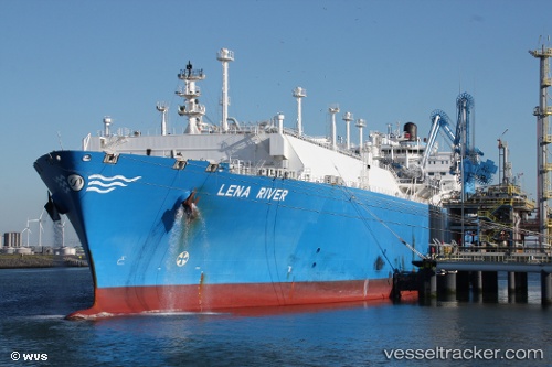
Lena River
Current StatusWhere is the vessel?
Lena River is currently in 126 nm W of Sanyang, based on AIS data received less than 1h ago.
Latest AIS update:
Current position: 13.07632° N, 18.88783° W (126 nm W of Sanyang)
Average speed (last 7 days): Loading…
Average speed (last 30 days): Loading…
Vessel profile: Lena River is a Lng Tanker with dimensions 44m x 290m.
This page combines live AIS, route history, probable destination signals, nearby traffic, and port activity for practical vessel monitoring.
The current position of vessel Lena River is 13.07632 lat / -18.88783 lng. Updated: 2026-05-15 13:49:02 UTCNearest reference points:
- 48 nm W of Cap Skiring
- Near Dakar
- Near Rufisque
Details:
Live Vessel Lena River Analytics (details, animations, etc.)
Recent AIS points (UTC):
2026-05-15 10:05:13 UTC · 12.19044, -18.65689 · SOG 14.5 kn · COG 343°2026-05-15 11:48:19 UTC · 12.59968, -18.76463 · SOG 14.5 kn · COG 348°
2026-05-15 13:05:57 UTC · 12.90509, -18.84689 · SOG 14.6 kn · COG 348°
2026-05-15 13:49:02 UTC · 13.07632, -18.88783 · SOG 14.4 kn · COG 348°