 vesseltracker.com
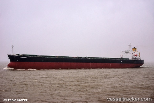
 Panasiatic
Current Status
Where is the vessel?
Panasiatic is currently in Near Port Said East, based on AIS data received less than 1h ago.
Latest AIS update:
Current position: 31.22602° N, 32.34484° E (Near Port Said East)
Average speed (last 7 days): Loading…
Average speed (last 30 days): Loading…
Vessel profile: Panasiatic is a Bulk Carrier with dimensions 229m x 32m.
This page combines live AIS, route history, probable destination signals, nearby traffic, and port activity for practical vessel monitoring.
The current position of vessel Panasiatic is 31.22602 lat / 32.34484 lng. Updated: 2026-05-16 16:23:52 UTCNearest reference points:
- Near Port Said East
- Near Port Said
- 14 nm N of Port Said
Currently sailing under the flag of Marshall Is ![]()
Panasiatic built in 2005 year
Deadweight:
82962 tDetails:
Live Vessel Panasiatic Analytics (details, animations, etc.)
Recent AIS points (UTC):
2026-05-16 13:26:16 UTC · 30.77667, 32.32667 · SOG 8 kn · COG -1°2026-05-16 14:02:52 UTC · 30.87349, 32.31583 · SOG 9.4 kn · COG 358°
2026-05-16 16:14:41 UTC · 31.20588, 32.33957 · SOG 7.3 kn · COG 10°
2026-05-16 16:23:52 UTC · 31.22602, 32.34484 · SOG 8.4 kn · COG 14°