 vesseltracker.com
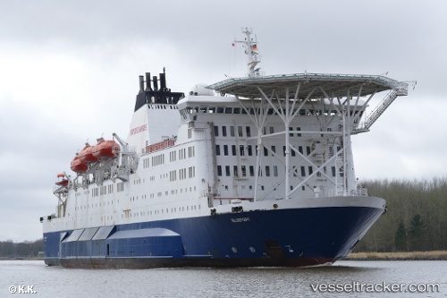
Bluefort
Current StatusWhere is the vessel?
Bluefort is currently in Near Nantong, based on AIS data received about 215d ago.
Latest AIS update:
Current position: 31.99677° N, 120.63872° E (Near Nantong)
Average speed (last 7 days): Loading…
Average speed (last 30 days): Loading…
Vessel profile: Bluefort is a Offshore Support Vessel with dimensions 20m x 141m.
This page combines live AIS, route history, probable destination signals, nearby traffic, and port activity for practical vessel monitoring.
The current position of vessel Bluefort is 31.99677 lat / 120.63872 lng. Updated: 2025-10-13 00:02:36 UTCNearest reference points:
- Near Nantong
- 10 nm E of Zhangjiagang
- Near Zhangjiagang
Details:
Live Vessel Bluefort Analytics (details, animations, etc.)
Recent AIS points (UTC):
2025-10-13 00:02:36 UTC · 31.99677, 120.63872 · SOG 9 kn · COG 105°