 vesseltracker.com
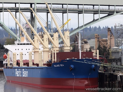
Inland Sea
Current StatusWhere is the vessel?
Inland Sea is currently in 37 nm N of Oracabessa, based on AIS data received about 1h ago.
Latest AIS update:
Current position: 18.99317° N, 76.79537° W (37 nm N of Oracabessa)
Average speed (last 7 days): Loading…
Average speed (last 30 days): Loading…
Vessel profile: Inland Sea is a Bulk Carrier with dimensions 30m x 180m.
This page combines live AIS, route history, probable destination signals, nearby traffic, and port activity for practical vessel monitoring.
The current position of vessel Inland Sea is 18.99317 lat / -76.79537 lng. Updated: 2026-04-28 17:22:49 UTCNearest reference points:
- 16 nm SE of Ceiba Hueca
Details:
Live Vessel Inland Sea Analytics (details, animations, etc.)
Recent AIS points (UTC):
2026-04-28 14:00:06 UTC · 18.77906, -76.07651 · SOG 12.5 kn · COG 290°2026-04-28 16:17:06 UTC · 18.92525, -76.56118 · SOG 12.8 kn · COG 284°
2026-04-28 16:22:06 UTC · 18.93043, -76.57911 · SOG 12.7 kn · COG 286°
2026-04-28 17:22:49 UTC · 18.99317, -76.79537 · SOG 12.9 kn · COG 285°