 vesseltracker.com
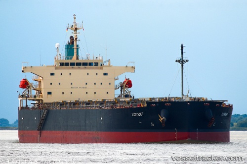
Lorient
Current StatusWhere is the vessel?
Lorient is currently in 51 nm NW of Caleta de Sebo, based on AIS data received about 3h ago.
Latest AIS update:
Current position: 29.77588° N, 14.25440° W (51 nm NW of Caleta de Sebo)
Average speed (last 7 days): Loading…
Average speed (last 30 days): Loading…
Vessel profile: Lorient is a Bulk Carrier with dimensions 32m x 225m.
This page combines live AIS, route history, probable destination signals, nearby traffic, and port activity for practical vessel monitoring.
The current position of vessel Lorient is 29.77588 lat / -14.25440 lng. Updated: 2026-04-25 00:28:05 UTCNearest reference points:
- 56 nm NW of Caleta de Sebo
- 58 nm N of Caleta de Sebo
- Near LAS COLORADAS
Details:
Live Vessel Lorient Analytics (details, animations, etc.)
Recent AIS points (UTC):
2026-04-24 22:42:00 UTC · 29.78182, -14.24649 · SOG 12.4 kn · COG 231°2026-04-24 23:30:40 UTC · 29.77850, -14.25092 · SOG 12.3 kn · COG 231°
2026-04-25 00:28:05 UTC · 29.77588, -14.25440 · SOG 12.3 kn · COG 231°
2026-04-25 00:28:05 UTC · 29.77588, -14.25440 · SOG 12.3 kn · COG 231°