 vesseltracker.com
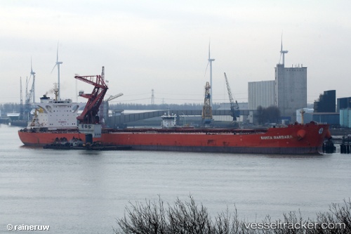
Santa Barbara
Current StatusWhere is the vessel?
Santa Barbara is currently in Near Bayuquan, based on AIS data received less than 1h ago.
Latest AIS update:
Current position: 40.29342° N, 122.08488° E (Near Bayuquan)
Average speed (last 7 days): Loading…
Average speed (last 30 days): Loading…
Vessel profile: Santa Barbara is a Bulk Carrier with dimensions 46m x 295m.
This page combines live AIS, route history, probable destination signals, nearby traffic, and port activity for practical vessel monitoring.
The current position of vessel Santa Barbara is 40.29342 lat / 122.08488 lng. Updated: 2026-05-12 19:25:46 UTCNearest reference points:
- Near Bayuquan
- 15 nm W of Bayuquan
- 17 nm SW of PANJIN
Details:
Live Vessel Santa Barbara Analytics (details, animations, etc.)
Recent AIS points (UTC):
2026-05-12 15:28:46 UTC · 40.29348, 122.08491 · SOG 0 kn · COG 64°2026-05-12 16:34:25 UTC · 40.29343, 122.08481 · SOG 0 kn · COG 63°
2026-05-12 17:52:46 UTC · 40.29333, 122.08484 · SOG 0 kn · COG 63°
2026-05-12 19:25:46 UTC · 40.29342, 122.08488 · SOG 0 kn · COG 64°