 vesseltracker.com
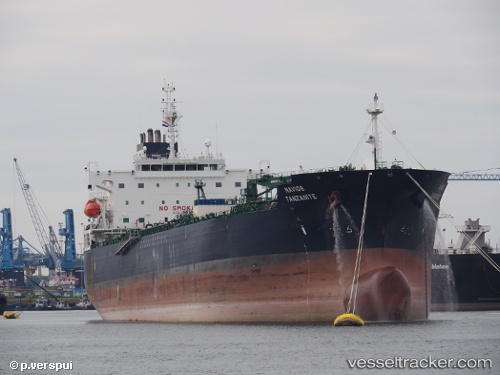
 Navig8 Tanzanite
Current Status
Where is the vessel?
Navig8 Tanzanite is currently in 12 nm SW of PORT DICKSON, based on AIS data received less than 1h ago.
Latest AIS update:
Current position: 2.34971° N, 101.67696° E (12 nm SW of PORT DICKSON)
Average speed (last 7 days): Loading…
Average speed (last 30 days): Loading…
Vessel profile: Navig8 Tanzanite is a Oil Products Tanker with dimensions 183m x 32m.
This page combines live AIS, route history, probable destination signals, nearby traffic, and port activity for practical vessel monitoring.
The current position of vessel Navig8 Tanzanite is 2.34971 lat / 101.67696 lng. Updated: 2026-05-16 12:26:18 UTCNearest reference points:
- 13 nm SW of PORT DICKSON
- Near PORT DICKSON
- 14 nm W of SUNGAI UDANG
Currently sailing under the flag of Marshall Is ![]()
Details:
Live Vessel Navig8 Tanzanite Analytics (details, animations, etc.)
Recent AIS points (UTC):
2026-05-16 07:52:22 UTC · 2.81875, 100.97698 · SOG 14.2 kn · COG 136°2026-05-16 10:17:39 UTC · 2.54609, 101.42831 · SOG 12.5 kn · COG 127°
2026-05-16 10:29:18 UTC · 2.52273, 101.45853 · SOG 10.6 kn · COG 128°
2026-05-16 12:26:18 UTC · 2.34971, 101.67696 · SOG 8.1 kn · COG 120°