 vesseltracker.com
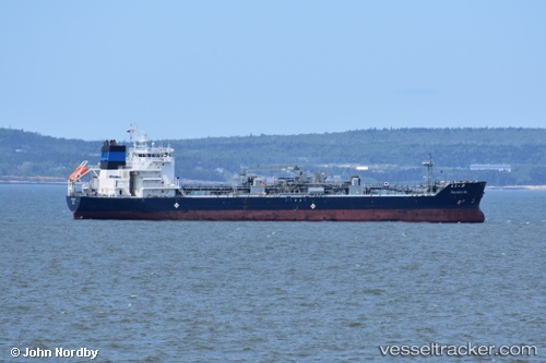
Palanca Rio
Current StatusWhere is the vessel?
Palanca Rio is currently in 69 nm SE of Frenchboro, based on AIS data received less than 1h ago.
Latest AIS update:
Current position: 43.06500° N, 67.70167° W (69 nm SE of Frenchboro)
Average speed (last 7 days): Loading…
Average speed (last 30 days): Loading…
Vessel profile: Palanca Rio is a Bitumen Tanker with dimensions 23m x 133m.
This page combines live AIS, route history, probable destination signals, nearby traffic, and port activity for practical vessel monitoring.
The current position of vessel Palanca Rio is 43.06500 lat / -67.70167 lng. Updated: 2026-05-15 14:13:45 UTCNearest reference points:
- Near Manset
- Near Surry
- 16 nm W of Tiverton
Details:
Live Vessel Palanca Rio Analytics (details, animations, etc.)
Recent AIS points (UTC):
2026-05-15 10:19:05 UTC · 43.72167, -67.26333 · SOG 12 kn · COG -1°2026-05-15 11:58:23 UTC · 43.44167, -67.44833 · SOG 11 kn · COG -1°
2026-05-15 13:52:40 UTC · 43.12333, -67.65667 · SOG 12 kn · COG -1°
2026-05-15 14:13:45 UTC · 43.06500, -67.70167 · SOG 12 kn · COG -1°