 vesseltracker.com
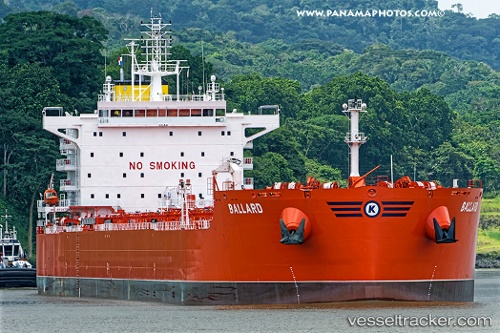
 Ballard
Current Status
Where is the vessel?
Ballard is currently in 237 nm W of Bolinao, based on AIS data received about 159d ago.
Latest AIS update:
Current position: 16.68188° N, 115.77258° E (237 nm W of Bolinao)
Average speed (last 7 days): Loading…
Average speed (last 30 days): Loading…
Vessel profile: Ballard is a Bulk Oil Carrier with dimensions 229m x 33m.
This page combines live AIS, route history, probable destination signals, nearby traffic, and port activity for practical vessel monitoring.
The current position of vessel Ballard is 16.68188 lat / 115.77258 lng. Updated: 2025-12-07 12:53:58 UTCNearest reference points:
- 222 nm W of Iba
- 138 nm NW of Bolinao
- 282 nm E of Tan Cang Qui Nhon
Currently sailing under the flag of Marshall Is ![]()
Details:
Live Vessel Ballard Analytics (details, animations, etc.)
Recent AIS points (UTC):
2025-12-07 12:53:58 UTC · 16.68188, 115.77258 · SOG 6.3 kn · COG 37°