 vesseltracker.com
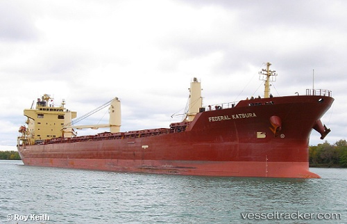
 FEDERAL KATSURA
Current Status
Where is the vessel?
FEDERAL KATSURA is currently in Near Annaba, based on AIS data received about 1h ago.
Latest AIS update:
Current position: 36.92855° N, 7.81968° E (Near Annaba)
Average speed (last 7 days): Loading…
Average speed (last 30 days): Loading…
Vessel profile: FEDERAL KATSURA is a Bulk Carrier with dimensions 190m x 24m.
This page combines live AIS, route history, probable destination signals, nearby traffic, and port activity for practical vessel monitoring.
The current position of vessel FEDERAL KATSURA is 36.92855 lat / 7.81968 lng. Updated: 2026-05-14 11:33:04 UTCNearest reference points:
- Near Annaba
- Near Skikid
- 35 nm S of Setubal
Currently sailing under the flag of Marshall Islands ![]()
FEDERAL KATSURA built in 2005 year
Deadweight:
32594 tDetails:
Live Vessel FEDERAL KATSURA Analytics (details, animations, etc.)
Recent AIS points (UTC):
2026-05-13 14:21:05 UTC · 36.92852, 7.82162 · SOG 0.1 kn · COG 339°2026-05-13 14:21:05 UTC · 36.92852, 7.82162 · SOG 0.1 kn · COG 339°
2026-05-14 10:24:04 UTC · 36.92838, 7.82023 · SOG 0.1 kn · COG 10°
2026-05-14 11:33:04 UTC · 36.92855, 7.81968 · SOG 0.1 kn · COG 28°