 vesseltracker.com
 Arabian Sea
Current Status
Where is the vessel?
Arabian Sea is currently in 14 nm SE of OMAEZAKI, based on AIS data received less than 1h ago.
Latest AIS update:
Current position: 34.50777° N, 138.45950° E (14 nm SE of OMAEZAKI)
Average speed (last 7 days): Loading…
Average speed (last 30 days): Loading…
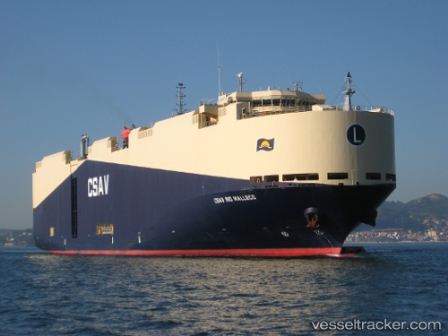
Vessel profile: Arabian Sea is a Vehicles Carrier with dimensions 183m x 183m.
This page combines live AIS, route history, probable destination signals, nearby traffic, and port activity for practical vessel monitoring.
The current position of vessel Arabian Sea is 34.50777 lat / 138.45950 lng. Updated: 2026-05-17 13:55:54 UTCNearest reference points:
- Near OMAEZAKI
- Near Iruma
- 10 nm SE of Iruma
Currently sailing under the flag of Marshall Is ![]()
Arabian Sea built in 2010 year
Deadweight:
13059 tDetails:
Live Vessel Arabian Sea Analytics (details, animations, etc.)
Recent AIS points (UTC):
2026-05-17 10:27:34 UTC · 34.49545, 137.55997 · SOG 13 kn · COG 90°2026-05-17 11:34:55 UTC · 34.50224, 137.86024 · SOG 13.5 kn · COG 90°
2026-05-17 13:50:44 UTC · 34.50563, 138.43770 · SOG 12.5 kn · COG 79°
2026-05-17 13:55:54 UTC · 34.50777, 138.45950 · SOG 12.7 kn · COG 79°