 vesseltracker.com
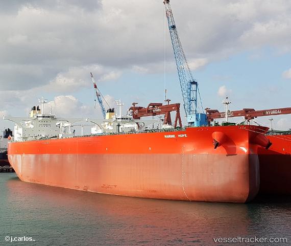
Marine Hope St
Current StatusWhere is the vessel?
Marine Hope St is currently in Near El Porvenir, based on AIS data received less than 1h ago.
Latest AIS update:
Current position: 8.21482° N, 82.87455° W (Near El Porvenir)
Average speed (last 7 days): Loading…
Average speed (last 30 days): Loading…
Vessel profile: Marine Hope St is a Crude Oil Tanker with dimensions 60m x 333m.
This page combines live AIS, route history, probable destination signals, nearby traffic, and port activity for practical vessel monitoring.
The current position of vessel Marine Hope St is 8.21482 lat / -82.87455 lng. Updated: 2026-05-16 11:25:38 UTCNearest reference points:
- Near Chiriquí Grande
- 20 nm S of El Puerto
Details:
Live Vessel Marine Hope St Analytics (details, animations, etc.)
Recent AIS points (UTC):
2026-05-16 08:01:36 UTC · 8.21482, -82.87453 · SOG 0 kn · COG 355°2026-05-16 10:10:40 UTC · 8.21481, -82.87454 · SOG 0 kn · COG 355°
2026-05-16 10:22:37 UTC · 8.21482, -82.87454 · SOG 0 kn · COG 355°
2026-05-16 11:25:38 UTC · 8.21482, -82.87455 · SOG 0 kn · COG 355°