 vesseltracker.com
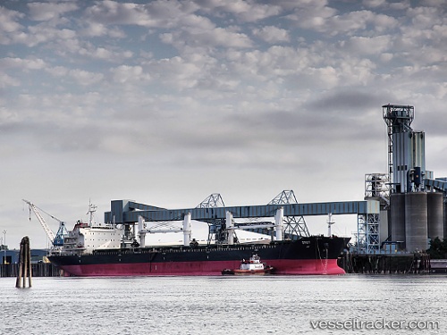
 KIRWAN
Current Status
Where is the vessel?
KIRWAN is currently in Near Ablogamé, based on AIS data received about 2h ago.
Latest AIS update:
Current position: 6.01561° N, 1.33402° E (Near Ablogamé)
Average speed (last 7 days): Loading…
Average speed (last 30 days): Loading…
Vessel profile: KIRWAN is a Bulk Carrier with dimensions 190m x 33m.
This page combines live AIS, route history, probable destination signals, nearby traffic, and port activity for practical vessel monitoring.
The current position of vessel KIRWAN is 6.01561 lat / 1.33402 lng. Updated: 2026-05-15 01:15:54 UTCNearest reference points:
- Near Ablogamé
- Near Cotonou
- Near Kirikiri
Currently sailing under the flag of Marshall Islands ![]()
KIRWAN built in 2008 year
Deadweight:
53208 tDetails:
Live Vessel KIRWAN Analytics (details, animations, etc.)
Recent AIS points (UTC):
2026-05-14 21:56:28 UTC · 6.01562, 1.33404 · SOG 0.4 kn · COG 213°2026-05-14 22:35:47 UTC · 6.01563, 1.33406 · SOG 0.6 kn · COG 215°
2026-05-14 23:54:19 UTC · 6.01574, 1.33390 · SOG 0.5 kn · COG 212°
2026-05-15 01:15:54 UTC · 6.01561, 1.33402 · SOG 0.3 kn · COG 217°