 vesseltracker.com
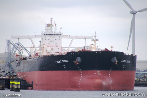
 FRONT SIGNE
Current Status
Where is the vessel?
FRONT SIGNE is currently in 292 nm NW of Tinaquillo, based on AIS data received less than 1h ago.
Latest AIS update:
Current position: 14.24583° N, 66.04514° E (292 nm NW of Tinaquillo)
Average speed (last 7 days): Loading…
Average speed (last 30 days): Loading…
Vessel profile: FRONT SIGNE is a Crude Oil Tanker with dimensions 330m x 330m.
This page combines live AIS, route history, probable destination signals, nearby traffic, and port activity for practical vessel monitoring.
The current position of vessel FRONT SIGNE is 14.24583 lat / 66.04514 lng. Updated: 2026-05-01 01:37:07 UTCNearest reference points:
- Open sea, approx. 401 nm off the nearest listed port
- Open sea, approx. 403 nm off the nearest listed port
- Open sea, approx. 404 nm off the nearest listed port
Currently sailing under the flag of Marshall Islands ![]()
FRONT SIGNE built in 2010 year
Deadweight:
297007 tDetails:
Live Vessel FRONT SIGNE Analytics (details, animations, etc.)
Recent AIS points (UTC):
2026-04-30 22:02:19 UTC · 14.27167, 66.01333 · SOG 0 kn · COG -1°2026-04-30 23:41:18 UTC · 14.26167, 66.03167 · SOG 0 kn · COG -1°
2026-05-01 00:59:16 UTC · 14.25167, 66.04167 · SOG 0 kn · COG -1°
2026-05-01 01:37:07 UTC · 14.24583, 66.04514 · SOG 0.7 kn · COG 185°