 vesseltracker.com
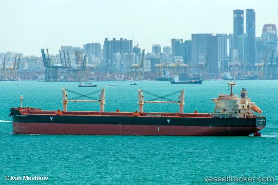
 ALIKI PERROTIS
Current Status
Where is the vessel?
ALIKI PERROTIS is currently in Near HAMRIYA, based on AIS data received less than 1h ago.
Latest AIS update:
Current position: 25.53261° N, 55.40969° E (Near HAMRIYA)
Average speed (last 7 days): Loading…
Average speed (last 30 days): Loading…
Vessel profile: ALIKI PERROTIS is a Bulk Carrier with dimensions 198m x 32m.
This page combines live AIS, route history, probable destination signals, nearby traffic, and port activity for practical vessel monitoring.
The current position of vessel ALIKI PERROTIS is 25.53261 lat / 55.40969 lng. Updated: 2026-04-28 18:24:14 UTCNearest reference points:
- Near AJMAN
- Near Sharjah
- Near Al Hamriyah
Currently sailing under the flag of Marshall Islands ![]()
ALIKI PERROTIS built in 2015 year
Deadweight:
60897 tDetails:
Live Vessel ALIKI PERROTIS Analytics (details, animations, etc.)
Recent AIS points (UTC):
2026-04-28 13:48:14 UTC · 25.53484, 55.41260 · SOG 0 kn · COG 262°2026-04-28 15:24:15 UTC · 25.53303, 55.41212 · SOG 0.1 kn · COG 325°
2026-04-28 16:54:14 UTC · 25.53238, 55.41034 · SOG 0.1 kn · COG 22°
2026-04-28 18:24:14 UTC · 25.53261, 55.40969 · SOG 0.1 kn · COG 40°