 vesseltracker.com
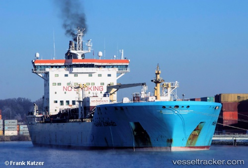
 TONDA
TONDA
Current Status
Where is the vessel?
TONDA is currently in 20 nm S of Tinaquillo, based on AIS data received about 5h ago.
Latest AIS update:
Current position: 9.58870° N, 68.38344° E (20 nm S of Tinaquillo)
Average speed (last 7 days): Loading…
Average speed (last 30 days): Loading…
Vessel profile: TONDA is a Chemical/Oil Products Tanker with dimensions 186m x 186m.
This page combines live AIS, route history, probable destination signals, nearby traffic, and port activity for practical vessel monitoring.
The current position of vessel TONDA is 9.58870 lat / 68.38344 lng. Updated: 2026-05-14 16:17:19 UTCNearest reference points:
- 98 nm S of Tinaquillo
- 119 nm SE of Tinaquillo
- 130 nm W of Lakshadweep
Currently sailing under the flag of Marshall Islands ![]()
TONDA built in 2005 year
Deadweight:
36803 tDetails:
Live Vessel TONDA Analytics (details, animations, etc.)
Recent AIS points (UTC):
2026-05-14 16:17:19 UTC · 9.58870, 68.38344 · SOG 12.1 kn · COG 290°2026-05-14 16:17:19 UTC · 9.58870, 68.38344 · SOG 12.1 kn · COG 290°
2026-05-14 16:17:19 UTC · 9.58870, 68.38344 · SOG 12.1 kn · COG 290°
2026-05-14 16:17:19 UTC · 9.58870, 68.38344 · SOG 12.1 kn · COG 290°