 vesseltracker.com
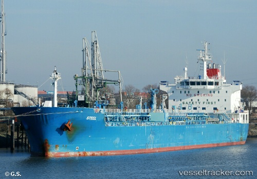
 STEEL
STEEL
Current Status
Where is the vessel?
STEEL is currently in 31 nm E of La Cruz de Illas, based on AIS data received less than 1h ago.
Latest AIS update:
Current position: 43.60500° N, 54.40333° W (31 nm E of La Cruz de Illas)
Average speed (last 7 days): Loading…
Average speed (last 30 days): Loading…
Vessel profile: STEEL is a Chemical/Oil Products Tanker with dimensions 184m x 184m.
This page combines live AIS, route history, probable destination signals, nearby traffic, and port activity for practical vessel monitoring.
The current position of vessel STEEL is 43.60500 lat / -54.40333 lng. Updated: 2026-04-30 09:58:58 UTCNearest reference points:
- 49 nm NW of La Cruz de Illas
- 28 nm NE of Valencia de San Juan
Currently sailing under the flag of Marshall Islands ![]()
STEEL built in 2008 year
Deadweight:
37538 tDetails:
Live Vessel STEEL Analytics (details, animations, etc.)
Recent AIS points (UTC):
2026-04-30 04:13:59 UTC · 42.67833, -54.96167 · SOG 9 kn · COG -1°2026-04-30 07:34:55 UTC · 43.14167, -54.66667 · SOG 6 kn · COG -1°
2026-04-30 07:50:17 UTC · 43.18104, -54.64933 · SOG 11.6 kn · COG 23°
2026-04-30 09:58:58 UTC · 43.60500, -54.40333 · SOG 13 kn · COG -1°