 vesseltracker.com
 CELSIUS LIVERPOOL
Current Status
Where is the vessel?
CELSIUS LIVERPOOL is currently in 12 nm N of Casablanca, based on AIS data received less than 1h ago.
Latest AIS update:
Current position: 33.80867° N, 7.68983° W (12 nm N of Casablanca)
Average speed (last 7 days): Loading…
Average speed (last 30 days): Loading…
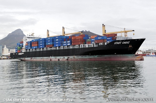
Vessel profile: CELSIUS LIVERPOOL is a Container Ship with dimensions 31m x 211m.
This page combines live AIS, route history, probable destination signals, nearby traffic, and port activity for practical vessel monitoring.
The current position of vessel CELSIUS LIVERPOOL is 33.80867 lat / -7.68983 lng. Updated: 2026-04-21 22:37:10 UTCNearest reference points:
- Near Mohammedia
- 54 nm N of El Jadida
- Near Jorf Lasfar
Currently sailing under the flag of Marshall Islands ![]()
CELSIUS LIVERPOOL built in 2010 year
Deadweight:
41234 tDetails:
Live Vessel CELSIUS LIVERPOOL Analytics (details, animations, etc.)
Recent AIS points (UTC):
2026-04-21 19:02:39 UTC · 33.77408, -7.57699 · SOG 1.1 kn · COG 13°2026-04-21 19:22:49 UTC · 33.77417, -7.57117 · SOG 3.3 kn · COG 296°
2026-04-21 21:31:48 UTC · 33.80909, -7.69831 · SOG 0.4 kn · COG 344°
2026-04-21 22:37:10 UTC · 33.80867, -7.68983 · SOG 0.3 kn · COG 354°