 vesseltracker.com
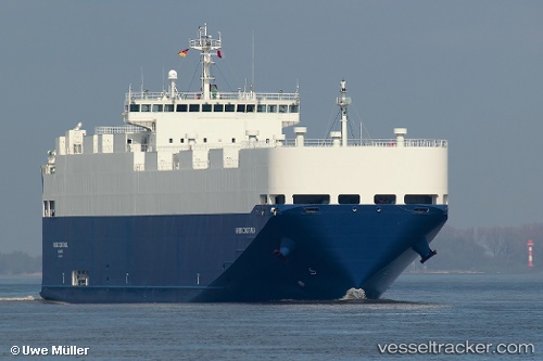
 VIKING CONSTANZA
Current Status
Where is the vessel?
VIKING CONSTANZA is currently in 41 nm N of Terschelling, based on AIS data received about 1h ago.
Latest AIS update:
Current position: 54.03167° N, 4.93500° E (41 nm N of Terschelling)
Average speed (last 7 days): Loading…
Average speed (last 30 days): Loading…
Vessel profile: VIKING CONSTANZA is a Vehicles Carrier with dimensions 140m x 140m.
This page combines live AIS, route history, probable destination signals, nearby traffic, and port activity for practical vessel monitoring.
The current position of vessel VIKING CONSTANZA is 54.03167 lat / 4.93500 lng. Updated: 2026-05-15 12:44:37 UTCNearest reference points:
- Near Molengat
- Near de Waal
- Near HARLINGEN
Currently sailing under the flag of Marshall Islands ![]()
VIKING CONSTANZA built in 2010 year
Deadweight:
5496 tDetails:
Live Vessel VIKING CONSTANZA Analytics (details, animations, etc.)
Recent AIS points (UTC):
2026-05-15 09:59:40 UTC · 54.58833, 5.39167 · SOG 15 kn · COG -1°2026-05-15 11:43:13 UTC · 54.20324, 5.06292 · SOG 15.1 kn · COG 205°
2026-05-15 12:44:37 UTC · 54.03167, 4.93500 · SOG 10 kn · COG -1°
2026-05-15 12:44:37 UTC · 54.03167, 4.93500 · SOG 10 kn · COG -1°