 vesseltracker.com
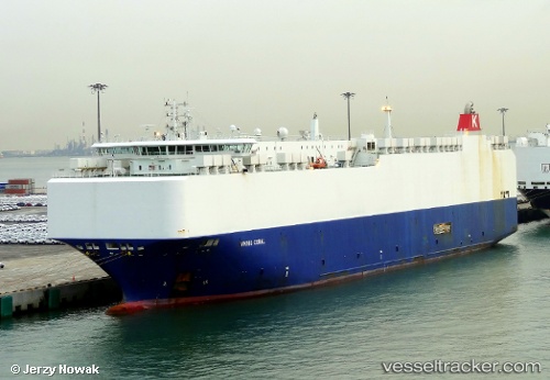
 VIKING CORAL
Current Status
Where is the vessel?
VIKING CORAL is currently in 10 nm SE of Daxie Pt, based on AIS data received less than 1h ago.
Latest AIS update:
Current position: 29.79012° N, 122.11534° E (10 nm SE of Daxie Pt)
Average speed (last 7 days): Loading…
Average speed (last 30 days): Loading…
Vessel profile: VIKING CORAL is a Vehicles Carrier with dimensions 167m x 28m.
This page combines live AIS, route history, probable destination signals, nearby traffic, and port activity for practical vessel monitoring.
The current position of vessel VIKING CORAL is 29.79012 lat / 122.11534 lng. Updated: 2026-05-16 13:18:53 UTCNearest reference points:
- 10 nm SE of Daxie Pt
- Near Daxie Pt
- Near ZHOUSHAN
Currently sailing under the flag of Marshall Islands ![]()
VIKING CORAL built in 2011 year
Deadweight:
12588 tDetails:
Live Vessel VIKING CORAL Analytics (details, animations, etc.)
Recent AIS points (UTC):
2026-05-16 09:30:55 UTC · 29.79011, 122.11535 · SOG 0 kn · COG 346°2026-05-16 10:39:58 UTC · 29.79011, 122.11535 · SOG 0 kn · COG 346°
2026-05-16 12:03:56 UTC · 29.79011, 122.11534 · SOG 0 kn · COG 346°
2026-05-16 13:18:53 UTC · 29.79012, 122.11534 · SOG 0 kn · COG 346°