 vesseltracker.com
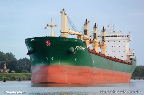
 JESSICA B
Current Status
Where is the vessel?
JESSICA B is currently in Near Isdemir, based on AIS data received less than 1h ago.
Latest AIS update:
Current position: 36.78108° N, 36.19053° E (Near Isdemir)
Average speed (last 7 days): Loading…
Average speed (last 30 days): Loading…
Vessel profile: JESSICA B is a Bulk Carrier with dimensions 199m x 24m.
This page combines live AIS, route history, probable destination signals, nearby traffic, and port activity for practical vessel monitoring.
The current position of vessel JESSICA B is 36.78108 lat / 36.19053 lng. Updated: 2026-05-16 09:22:26 UTCNearest reference points:
- Near DORTYOL
- Near Iskenderun
- Near CEYHAN
Currently sailing under the flag of Marshall Islands ![]()
JESSICA B built in 2003 year
Deadweight:
37384 tDetails:
Live Vessel JESSICA B Analytics (details, animations, etc.)
Recent AIS points (UTC):
2026-05-16 05:46:26 UTC · 36.78105, 36.19052 · SOG 0 kn · COG 357°2026-05-16 07:34:26 UTC · 36.78104, 36.19053 · SOG 0 kn · COG 3°
2026-05-16 08:25:26 UTC · 36.78104, 36.19052 · SOG 0 kn · COG 122°
2026-05-16 09:22:26 UTC · 36.78108, 36.19053 · SOG 0 kn · COG 347°