 vesseltracker.com
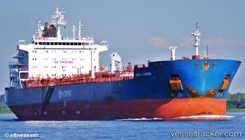
 LA DIGUE
Current Status
Where is the vessel?
LA DIGUE is currently in 160 nm W of Trakovice, based on AIS data received less than 1h ago.
Latest AIS update:
Current position: 47.91376° N, 166.77280° E (160 nm W of Trakovice)
Average speed (last 7 days): Loading…
Average speed (last 30 days): Loading…
Vessel profile: LA DIGUE is a Chemical/Oil Products Tanker with dimensions 32m x 183m.
This page combines live AIS, route history, probable destination signals, nearby traffic, and port activity for practical vessel monitoring.
The current position of vessel LA DIGUE is 47.91376 lat / 166.77280 lng. Updated: 2026-05-17 11:58:34 UTCCurrently sailing under the flag of Marshall Islands ![]()
LA DIGUE built in 2011 year
Deadweight:
50281 tDetails:
Live Vessel LA DIGUE Analytics (details, animations, etc.)
Recent AIS points (UTC):
2026-05-17 08:16:50 UTC · 47.73459, 165.59485 · SOG 13.3 kn · COG 76°2026-05-17 10:14:01 UTC · 47.83040, 166.21521 · SOG 13.3 kn · COG 75°
2026-05-17 10:14:01 UTC · 47.83040, 166.21521 · SOG 13.3 kn · COG 75°
2026-05-17 11:58:34 UTC · 47.91376, 166.77280 · SOG 13.1 kn · COG 75°