 vesseltracker.com
 EMMA GRACE
Current Status
Where is the vessel?
EMMA GRACE is currently in 25 nm S of Jubilee FPSO, based on AIS data received less than 1h ago.
Latest AIS update:
Current position: 4.19815° N, 2.92467° W (25 nm S of Jubilee FPSO)
Average speed (last 7 days): Loading…
Average speed (last 30 days): Loading…
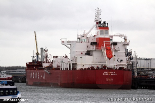
Vessel profile: EMMA GRACE is a Chemical/Oil Products Tanker with dimensions 32m x 183m.
This page combines live AIS, route history, probable destination signals, nearby traffic, and port activity for practical vessel monitoring.
The current position of vessel EMMA GRACE is 4.19815 lat / -2.92467 lng. Updated: 2026-05-01 18:21:54 UTCNearest reference points:
- 13 nm W of Jubilee FPSO
- Near Takoradi
- Near Sekondi
Currently sailing under the flag of Marshall Islands ![]()
EMMA GRACE built in 2015 year
Deadweight:
49997 tDetails:
Live Vessel EMMA GRACE Analytics (details, animations, etc.)
Recent AIS points (UTC):
2026-05-01 13:59:31 UTC · 4.34664, -1.94982 · SOG 13.3 kn · COG 255°2026-05-01 15:41:12 UTC · 4.29415, -2.32575 · SOG 13.4 kn · COG 260°
2026-05-01 16:06:03 UTC · 4.28188, -2.41780 · SOG 13.6 kn · COG 260°
2026-05-01 18:21:54 UTC · 4.19815, -2.92467 · SOG 13.8 kn · COG 258°