 vesseltracker.com
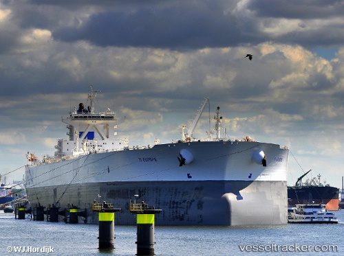
 EUROPE
Current Status
Where is the vessel?
EUROPE is currently in 30 nm NW of Sendhwa, based on AIS data received about 433d ago.
Latest AIS update:
Current position: 22.12947° N, 74.87200° E (30 nm NW of Sendhwa)
Average speed (last 7 days): Loading…
Average speed (last 30 days): Loading…
Vessel profile: EUROPE is a Crude Oil Tanker with dimensions 68m x 379m.
This page combines live AIS, route history, probable destination signals, nearby traffic, and port activity for practical vessel monitoring.
The current position of vessel EUROPE is 22.12947 lat / 74.87200 lng. Updated: 2025-03-07 13:43:31 UTCNearest reference points:
- Near Gandhar
- Near DAHEJ
Currently sailing under the flag of Marshall Islands ![]()
EUROPE built in 2002 year
Deadweight:
441561 tDetails:
Live Vessel EUROPE Analytics (details, animations, etc.)
Recent AIS points (UTC):
2025-03-07 13:43:31 UTC · 22.12947, 74.87200 · SOG 9.8 kn · COG 135°