 vesseltracker.com
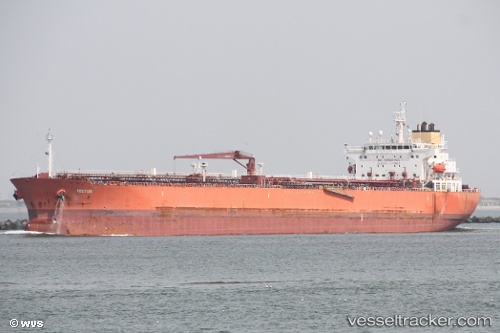
 LIBERTY
Current Status
Where is the vessel?
LIBERTY is currently in 36 nm SE of Laurieton, based on AIS data received about 79d ago.
Latest AIS update:
Current position: 32.03011° S, 153.33717° E (36 nm SE of Laurieton)
Average speed (last 7 days): Loading…
Average speed (last 30 days): Loading…
Vessel profile: LIBERTY is a Oil Products Tanker with dimensions 32m x 228m.
This page combines live AIS, route history, probable destination signals, nearby traffic, and port activity for practical vessel monitoring.
The current position of vessel LIBERTY is -32.03011 lat / 153.33717 lng. Updated: 2026-02-12 00:21:00 UTCNearest reference points:
- Near Warners Bay
- Near Caves Beach
- Near BILGOLA PLATEAU
Currently sailing under the flag of Marshall Islands ![]()
LIBERTY built in 2009 year
Deadweight:
74862 tDetails:
Live Vessel LIBERTY Analytics (details, animations, etc.)
Recent AIS points (UTC):
2026-02-12 00:21:00 UTC · -32.03011, 153.33717 · SOG 13.6 kn · COG 196°