 vesseltracker.com
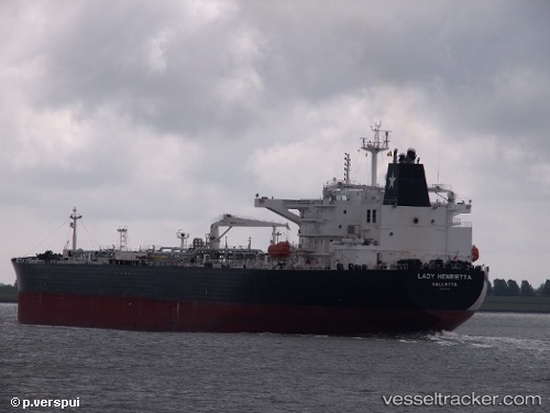
 LADY HENRIETTA
Current Status
Where is the vessel?
LADY HENRIETTA is currently in Open sea (no nearby ports in database), based on AIS data received about 1h ago.
Latest AIS update:
Current position: 3.78333° S, 82.85333° E (Open sea (no nearby ports in database))
Average speed (last 7 days): Loading…
Average speed (last 30 days): Loading…
Vessel profile: LADY HENRIETTA is a Crude Oil Tanker with dimensions 44m x 250m.
This page combines live AIS, route history, probable destination signals, nearby traffic, and port activity for practical vessel monitoring.
The current position of vessel LADY HENRIETTA is -3.78333 lat / 82.85333 lng. Updated: 2026-04-02 19:46:21 UTCNearest reference points:
- Open sea (no nearby ports in database)
Currently sailing under the flag of Marshall Islands ![]()
LADY HENRIETTA built in 2012 year
Deadweight:
111815 tDetails:
Live Vessel LADY HENRIETTA Analytics (details, animations, etc.)
Recent AIS points (UTC):
2026-04-02 13:59:43 UTC · -3.00271, 83.75552 · SOG 12.4 kn · COG 224°2026-04-02 15:43:15 UTC · -3.23667, 83.49333 · SOG 12 kn · COG -1°
2026-04-02 17:25:14 UTC · -3.46833, 83.22500 · SOG 12 kn · COG -1°
2026-04-02 19:46:21 UTC · -3.78333, 82.85333 · SOG 12 kn · COG -1°