 vesseltracker.com
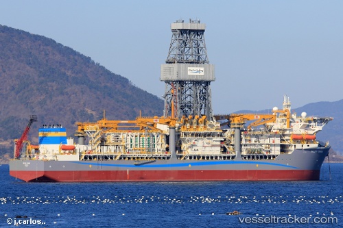
 PACIFIC ZONDA
Current Status
Where is the vessel?
PACIFIC ZONDA is currently in 30 nm SW of Erawan, based on AIS data received about 140d ago.
Latest AIS update:
Current position: 8.69647° N, 101.06065° E (30 nm SW of Erawan)
Average speed (last 7 days): Loading…
Average speed (last 30 days): Loading…
Vessel profile: PACIFIC ZONDA is a Drilling Ship with dimensions 42m x 228m.
This page combines live AIS, route history, probable destination signals, nearby traffic, and port activity for practical vessel monitoring.
The current position of vessel PACIFIC ZONDA is 8.69647 lat / 101.06065 lng. Updated: 2025-12-25 16:28:21 UTCNearest reference points:
- Near Samui Apt
- Near Ko Samui
- Near Nakhon Si Thammarat
Currently sailing under the flag of Marshall Islands ![]()
PACIFIC ZONDA built in 2023 year
Deadweight:
58183 tDetails:
Live Vessel PACIFIC ZONDA Analytics (details, animations, etc.)
Recent AIS points (UTC):
2025-12-25 16:28:21 UTC · 8.69647, 101.06065 · SOG 68.7 kn · COG 148°