 vesseltracker.com
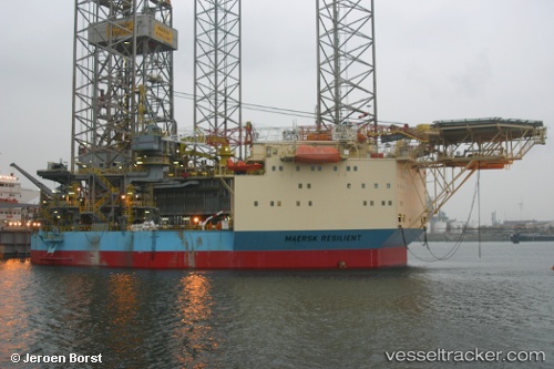
 NOBLE RESILIENT
Current Status
Where is the vessel?
NOBLE RESILIENT is currently in 39 nm N of Town Quays/Drogheda, based on AIS data received less than 1h ago.
Latest AIS update:
Current position: 54.36871° N, 6.18664° E (39 nm N of Town Quays/Drogheda)
Average speed (last 7 days): Loading…
Average speed (last 30 days): Loading…
Vessel profile: NOBLE RESILIENT is a Drilling Jack Up with dimensions m x m.
This page combines live AIS, route history, probable destination signals, nearby traffic, and port activity for practical vessel monitoring.
The current position of vessel NOBLE RESILIENT is 54.36871 lat / 6.18664 lng. Updated: 2026-04-26 16:03:25 UTCNearest reference points:
- 14 nm NW of Town Quays/Drogheda
- Near Borkum
- Near NORDERNEY
Currently sailing under the flag of Marshall Islands ![]()
Details:
Live Vessel NOBLE RESILIENT Analytics (details, animations, etc.)
Recent AIS points (UTC):
2026-04-26 11:57:22 UTC · 54.36870, 6.18665 · SOG 0 kn · COG 45°2026-04-26 13:00:21 UTC · 54.36877, 6.18665 · SOG 0 kn · COG 44°
2026-04-26 14:00:23 UTC · 54.36865, 6.18668 · SOG 0 kn · COG 44°
2026-04-26 16:03:25 UTC · 54.36871, 6.18664 · SOG 0 kn · COG 44°