 vesseltracker.com
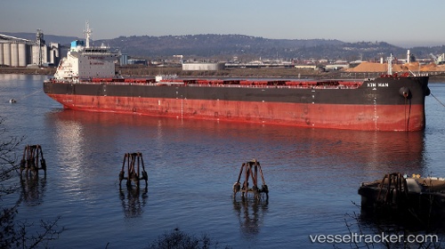
 RG LUNA
Current Status
Where is the vessel?
RG LUNA is currently in 55 nm S of Goudiniweg, based on AIS data received less than 1h ago.
Latest AIS update:
Current position: 35.48998° S, 19.09667° E (55 nm S of Goudiniweg)
Average speed (last 7 days): Loading…
Average speed (last 30 days): Loading…
Vessel profile: RG LUNA is a Bulk Carrier with dimensions m x m.
This page combines live AIS, route history, probable destination signals, nearby traffic, and port activity for practical vessel monitoring.
The current position of vessel RG LUNA is -35.48998 lat / 19.09667 lng. Updated: 2026-04-30 17:44:46 UTCNearest reference points:
- 15 nm SE of Moorreesburg
- 18 nm SW of Cape Of Good Hope
- Near Mitchells Plain
Currently sailing under the flag of Marshall Islands ![]()
Details:
Live Vessel RG LUNA Analytics (details, animations, etc.)
Recent AIS points (UTC):
2026-04-30 13:56:15 UTC · -35.54951, 18.38519 · SOG 9.2 kn · COG 83°2026-04-30 15:48:17 UTC · -35.52102, 18.73599 · SOG 9.3 kn · COG 88°
2026-04-30 17:03:55 UTC · -35.50234, 18.97192 · SOG 9.1 kn · COG 88°
2026-04-30 17:44:46 UTC · -35.48998, 19.09667 · SOG 9 kn · COG 86°