 vesseltracker.com
 MINH PROVIDENCE
Current Status
Where is the vessel?
MINH PROVIDENCE is currently in 156 nm SW of Al Azaiba, based on AIS data received about 1h ago.
Latest AIS update:
Current position: 24.68279° S, 55.94513° E (156 nm SW of Al Azaiba)
Average speed (last 7 days): Loading…
Average speed (last 30 days): Loading…
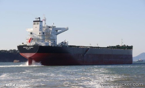
Vessel profile: MINH PROVIDENCE is a Bulk Carrier with dimensions m x m.
This page combines live AIS, route history, probable destination signals, nearby traffic, and port activity for practical vessel monitoring.
The current position of vessel MINH PROVIDENCE is -24.68279 lat / 55.94513 lng. Updated: 2026-04-25 20:02:47 UTCNearest reference points:
- 129 nm W of Al Azaiba
- 61 nm NW of Al Azaiba
Currently sailing under the flag of Marshall Islands ![]()
Details:
Live Vessel MINH PROVIDENCE Analytics (details, animations, etc.)
Recent AIS points (UTC):
2026-04-25 16:54:50 UTC · -24.91716, 55.52532 · SOG 8.2 kn · COG 59°2026-04-25 18:11:27 UTC · -24.82458, 55.69633 · SOG 8.6 kn · COG 56°
2026-04-25 19:34:38 UTC · -24.71889, 55.88417 · SOG 8.4 kn · COG 53°
2026-04-25 20:02:47 UTC · -24.68279, 55.94513 · SOG 8.2 kn · COG 56°