 vesseltracker.com
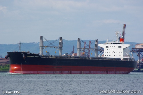
 HAATO
HAATO
Current Status
Where is the vessel?
HAATO is currently in 152 nm SE of Benahavis, based on AIS data received about 1h ago.
Latest AIS update:
Current position: 35.34743° N, 47.73664° W (152 nm SE of Benahavis)
Average speed (last 7 days): Loading…
Average speed (last 30 days): Loading…
Vessel profile: HAATO is a Bulk Carrier with dimensions m x m.
This page combines live AIS, route history, probable destination signals, nearby traffic, and port activity for practical vessel monitoring.
The current position of vessel HAATO is 35.34743 lat / -47.73664 lng. Updated: 2026-04-27 23:00:12 UTCCurrently sailing under the flag of Marshall Islands ![]()
Details:
Live Vessel HAATO Analytics (details, animations, etc.)
Recent AIS points (UTC):
2026-04-27 19:49:29 UTC · 35.23692, -48.38218 · SOG 9.6 kn · COG 79°2026-04-27 20:09:59 UTC · 35.24900, -48.31670 · SOG 9.8 kn · COG 81°
2026-04-27 21:44:54 UTC · 35.29926, -47.99738 · SOG 10.5 kn · COG 83°
2026-04-27 23:00:12 UTC · 35.34743, -47.73664 · SOG 10.7 kn · COG 79°