 vesseltracker.com
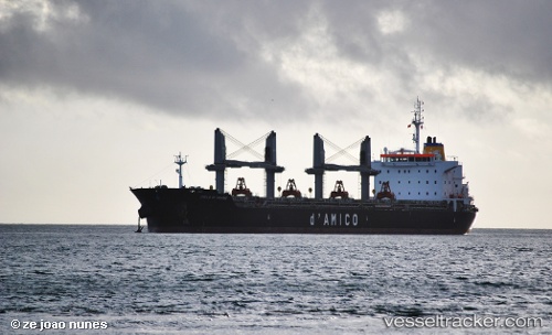
 MARMOR
Current Status
Where is the vessel?
MARMOR is currently in 11 nm S of Cameron, based on AIS data received less than 1h ago.
Latest AIS update:
Current position: 29.60081° N, 93.25848° W (11 nm S of Cameron)
Average speed (last 7 days): Loading…
Average speed (last 30 days): Loading…
Vessel profile: MARMOR is a Bulk Carrier with dimensions m x m.
This page combines live AIS, route history, probable destination signals, nearby traffic, and port activity for practical vessel monitoring.
The current position of vessel MARMOR is 29.60081 lat / -93.25848 lng. Updated: 2026-04-29 00:05:35 UTCNearest reference points:
- Near Carlyss
- Near Lake Charles
- Near Lake Arthur
Currently sailing under the flag of Marshall Islands ![]()
Details:
Live Vessel MARMOR Analytics (details, animations, etc.)
Recent AIS points (UTC):
2026-04-28 19:41:30 UTC · 29.60070, -93.25900 · SOG 0.2 kn · COG 155°2026-04-28 22:20:31 UTC · 29.60065, -93.25907 · SOG 0.1 kn · COG 141°
2026-04-28 23:02:30 UTC · 29.60059, -93.25900 · SOG 0.3 kn · COG 134°
2026-04-29 00:05:35 UTC · 29.60081, -93.25848 · SOG 0.4 kn · COG 153°