 vesseltracker.com
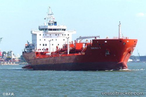
 TRISTAR NATASHA
Current Status
Where is the vessel?
TRISTAR NATASHA is currently in 19 nm N of Luperon, based on AIS data received about 2h ago.
Latest AIS update:
Current position: 20.22002° N, 70.90213° W (19 nm N of Luperon)
Average speed (last 7 days): Loading…
Average speed (last 30 days): Loading…
Vessel profile: TRISTAR NATASHA is a Tanker with dimensions m x m.
This page combines live AIS, route history, probable destination signals, nearby traffic, and port activity for practical vessel monitoring.
The current position of vessel TRISTAR NATASHA is 20.22002 lat / -70.90213 lng. Updated: 2026-05-01 20:03:11 UTCNearest reference points:
- Near Puerto Plata
- 38 nm SW of Cockburn Harbour
- 56 nm SW of Cockburn Harbour
Currently sailing under the flag of Marshall Islands ![]()
Details:
Live Vessel TRISTAR NATASHA Analytics (details, animations, etc.)
Recent AIS points (UTC):
2026-05-01 16:12:59 UTC · 19.98678, -70.01763 · SOG 13.6 kn · COG 284°2026-05-01 17:51:29 UTC · 20.09048, -70.39911 · SOG 13.5 kn · COG 282°
2026-05-01 19:35:10 UTC · 20.19184, -70.79433 · SOG 13.5 kn · COG 284°
2026-05-01 20:03:11 UTC · 20.22002, -70.90213 · SOG 13.7 kn · COG 284°